
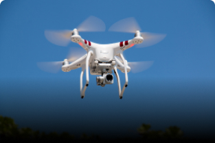
Agriculture is evolving rapidly with the integration of advanced technologies that help farmers improve productivity, reduce costs, and manage resources more efficiently. One of the most significant innovations transforming modern agriculture is drone engineering. By combining unmanned aerial vehicles (UAVs), sensors, GPS technology, artificial intelligence (AI), and data analytics, drone engineering is making farming smarter, more precise, and more sustainable.
From monitoring crop health to spraying fertilizers and pesticides, agricultural drones are helping farmers make informed decisions and increase operational efficiency. As smart farming continues to grow, drone technology is becoming an important part of the future of agriculture.
What Is Drone Engineering in Agriculture?
Drone engineering involves designing, developing, operating, and maintaining unmanned aerial vehicles for various applications. In agriculture, these drones are equipped with specialized cameras, sensors, GPS systems, and other tools to collect valuable information about farmland.
Agricultural drones can capture aerial images, analyze crop conditions, identify irrigation problems, and apply agricultural inputs to specific areas. This technology enables farmers to monitor large fields quickly and accurately compared with many traditional inspection methods.
Drone engineering also supports precision agriculture, an approach that uses data and technology to manage crops according to their specific needs.
Key Applications of Drone Engineering in Smart Farming
1. Crop Health Monitoring
Monitoring crop health is essential for maintaining agricultural productivity. Agricultural drones equipped with RGB, multispectral, or thermal cameras can capture detailed images of crops and help identify potential problems.
These images can reveal signs of plant stress, nutrient deficiencies, pest damage, or disease before the issues become widespread. Farmers can use this information to take timely action and protect their crops.
2. Precision Spraying of Fertilizers and Pesticides
Drone technology allows farmers to apply fertilizers, pesticides, and other agricultural treatments to targeted areas. Instead of treating an entire field uniformly, farmers can focus on locations that require attention.
Precision spraying can help reduce unnecessary chemical use, save time, and improve application efficiency when drones are properly calibrated and operated. However, safe spraying depends on weather conditions, suitable equipment, and compliance with agricultural and aviation regulations.
3. Soil and Field Analysis
Understanding soil conditions is important for effective farming. Drones can collect aerial data that helps identify variations in field conditions, drainage patterns, erosion, and areas where crops may be growing poorly.
When combined with soil tests and geographic information systems (GIS), drone-generated maps can help farmers make better decisions about land preparation, fertilizer application, and crop management.
4. Smart Irrigation Management
Water conservation is a major priority in modern agriculture. Drones equipped with thermal or multispectral sensors can help identify areas experiencing water stress or uneven irrigation.
Farmers can use these insights to investigate irrigation problems, improve watering schedules, and reduce water waste. When drone data is combined with soil-moisture sensors and weather information, irrigation management can become more precise and efficient.
5. Pest and Disease Detection
Pests and plant diseases can cause significant crop losses if they are not identified early. Drone-based imaging helps farmers inspect large agricultural areas and locate unusual crop patterns that may indicate an emerging problem.
Although drone imagery cannot always confirm the exact pest or disease, it helps farmers identify areas that require closer inspection. Early detection can support faster intervention and more effective crop protection.
6. Crop Mapping and Field Surveying
Drones can produce detailed aerial maps of agricultural land. These maps help farmers understand field boundaries, estimate planted areas, monitor crop growth, and plan farming activities.
Drone-based surveying can also support the assessment of orchards, plantations, and large farms where manual inspection may be time-consuming.
How Drone Engineering Supports Smart Farming
Smart farming combines digital technologies to improve agricultural decisions and resource management. Drone engineering contributes to this approach by collecting timely, location-specific information.
Here are some important technologies that make agricultural drones more effective:
- GPS and GNSS: Help drones navigate fields and record the locations of collected data.
- Artificial intelligence: Supports image analysis, crop-stress identification, and automated data interpretation.
- Internet of Things (IoT): Connects drone data with soil sensors, weather stations, and irrigation systems.
- Multispectral imaging: Helps assess vegetation conditions using different wavelengths of light.
- Thermal imaging: Helps identify temperature variations associated with possible water stress or other crop problems.
- Data analytics: Converts aerial observations into useful information for agricultural planning.
Together, these technologies help farmers move from reactive farming practices toward more data-driven and proactive crop management.
Benefits of Drone Engineering in Agriculture
Drone engineering offers several benefits that can improve agricultural operations.
Improved Efficiency
Drones can survey large fields in less time than many manual inspection methods. This helps farmers identify problems quickly and allocate their time more effectively.
Reduced Operational Costs
By identifying areas that need specific treatments, drones may help reduce unnecessary spending on fertilizers, pesticides, water, and labor. Actual savings depend on farm size, equipment costs, and how effectively the technology is used.
Better Crop Management
Frequent aerial monitoring provides farmers with valuable information about crop development. This can support timely decisions and help prevent small problems from becoming larger ones.
Increased Resource Efficiency
Targeted spraying and data-guided irrigation can improve the use of agricultural inputs, helping farmers manage resources more responsibly.
Enhanced Farm Safety
Drones can reduce the need for workers to enter certain hazardous or difficult-to-access areas. Spray drones may also reduce direct worker exposure to agricultural chemicals when operated with appropriate safety procedures.
Support for Sustainable Agriculture
By helping farmers identify where resources are needed, drones can contribute to more efficient farming practices and potentially reduce unnecessary chemical and water use.
Challenges of Using Drones in Agriculture
Despite their advantages, agricultural drones also present several challenges.
High initial investment: Purchasing drones, sensors, batteries, and data-processing software can be expensive for small-scale farmers.
Technical expertise: Operating drones and interpreting aerial data require appropriate training and technical knowledge.
Battery limitations: Many drones have limited flight times and may require frequent battery changes when covering large fields.
Weather conditions: Strong winds, rain, and extreme temperatures can affect drone operations and data collection.
Data management: High-resolution images may require specialized software, storage, and expertise to interpret correctly.
Regulatory compliance: Drone operations must follow applicable aviation, privacy, and agricultural spraying requirements. In India, farmers and operators should check current Directorate General of Civil Aviation (DGCA) requirements and relevant restrictions before flying.
Addressing these challenges through training, accessible services, and suitable regulations can help more farmers benefit from drone technology.
The Future of Drone Engineering in Agriculture
The future of drone engineering in agriculture is closely connected to developments in AI, automation, robotics, and connected farming systems.
AI-powered drones may increasingly help identify crop problems, classify weeds, and generate recommendations from aerial imagery. Autonomous flight planning can make routine field surveys more efficient, while improved batteries and sensors may expand the range of agricultural applications.
Another promising development is the integration of drones with IoT-based irrigation systems, satellite imagery, and farm management software. This combination can provide farmers with a more complete understanding of field conditions and help them make better-informed decisions.
In India, agricultural drone initiatives and the growth of precision-farming services are creating opportunities for technology providers, agricultural professionals, and trained drone operators. Wider adoption will depend on affordability, reliable support, farmer training, and measurable benefits for different types of farms.
Career Opportunities in Agricultural Drone Engineering
The growing use of drones in agriculture is creating career opportunities for people interested in engineering, aviation, agriculture, and technology.
Some potential career paths include:
- Agricultural Drone Engineer: Designs and develops drones for farming applications.
- UAV Pilot or Operator: Conducts agricultural surveys and drone-based operations, subject to applicable training and certification requirements.
- Drone Software Developer: Develops software for flight control, mapping, and automated data processing.
- Agricultural Data Analyst: Analyzes drone imagery and other agricultural data to support farm management.
- Precision Agriculture Specialist: Helps farmers use technology to improve crop productivity and resource efficiency.
- Drone Maintenance Technician: Inspects, repairs, and maintains agricultural drone systems.
Students interested in this field can build relevant skills in electronics, mechanical engineering, robotics, programming, GIS, remote sensing, and agricultural technology.
Conclusion
Drone engineering is transforming agriculture by helping farmers monitor crops, manage irrigation, apply agricultural treatments, and analyze farmland more efficiently. Through technologies such as GPS, AI, IoT, and advanced imaging, drones are making precision agriculture more practical and accessible.
Although challenges such as equipment costs, technical training, weather limitations, and regulations remain, continued innovation may make agricultural drones increasingly useful for farms of different sizes.
As smart farming develops, drone engineering will play an important role in improving agricultural decision-making, optimizing resource use, and supporting more sustainable farming practices.
Frequently Asked Questions (FAQs)
1. What is the role of drones in smart farming?
Drones help farmers monitor crop health, map fields, identify irrigation problems, detect possible pest damage, and apply fertilizers or pesticides to targeted areas.
2. How do agricultural drones improve crop productivity?
They provide timely field information that helps farmers identify crop problems, manage resources more effectively, and make informed decisions about crop care.
3. Which technologies are used in agricultural drones?
Common technologies include GPS, AI, IoT, RGB and multispectral cameras, thermal sensors, GIS, and data analytics.
4. Are agricultural drones useful for small farmers?
Yes. Small farmers may benefit from drone services for crop monitoring, mapping, and spraying without purchasing their own equipment. Affordability and access to trained operators remain important considerations.
5. What skills are required for a career in agricultural drone engineering?
Useful skills include electronics, robotics, programming, drone operation, remote sensing, GIS, data analysis, and knowledge of agricultural practices.


